- MTB
- Montezuma Falls
Montezuma Falls
Hot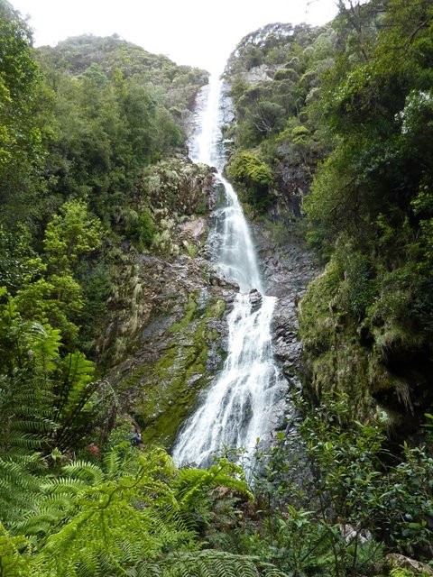
Key Statistics
- State Forest
Location
Overview

If you're heading over to the West Coast, then this would have to be the number one ride on your agenda. The route follows an old railway line through some beautiful forests to the 114m Montezuma Falls. The route can be broken into a number of sections from a short (11km) out and back ride along a gentle, easy to ride trail from the Northern end of the track though to a 55km out and back epic starting and ending in Zeehan.
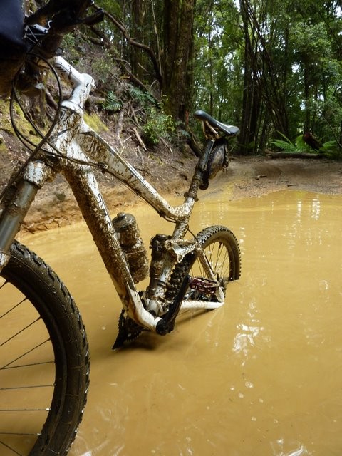
The core of the ride is the 14km section (each way) from Melba Flats to Montezuma Falls where you'll get to play in the mud, race 4WD's, plunge through deep washouts and really get some serious mountain biking in. Finally, for the well prepared and adventurous the final 8kms from Melba Flats to Zeehan crosses through button grass plains providing expansive views which you'll have plenty of time to enjoy as you push, bash and swim your bike along what was once a railway line.
GETTING THERE
Williamsford carpark is reached via a turnoff about 2kms south of Rosebery on the Murchison Highway. Look for signs to Montezuma Falls (Duh!) and is the best starting point if just doing the easy Northern Section to the falls or if going one way.
The Melba Flats starting point is better for those doing the out and back option (get the hard stuff out of the way to start with). Melba Flats is 4.5km North of the Zeehan turn off, or 20kms south of Rosebery, look for the signed junction to Melba Flats.
If including the Zeehan to Melba flats section, then start near the end of Robinson Street. As you get to the outer limits of Zeehan on this road, you'll cross a small bridge, about 300metres past here the road turns sharp left and there's a small track continuing off to the right. Drive down this track a short way and park the car off the road (there's a small quarry on the right) then continue on the track on your bike. You'll see some pines on your right just after crossing a small creek with the tell tale signs of railway poles between you and the pines. Head over to these and you're on the track.
ROUTE OPTIONS
The track can be broken into three section:
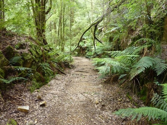
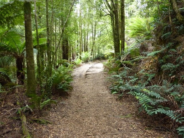
1. Williamsford carpark (Northern End) to Montezuma Falls: 5.5km each way. Mainly easy riding on good surface, it's not flat though. Great family trip with the kids. 45 mins - 2hrs depending on your group and desire.
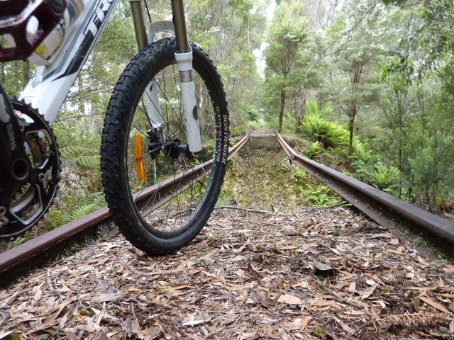
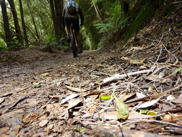
2. Melba Flats - Montezuma Falls : 14km each way. This is medium difficulty riding, and not to be underestimated, especially in the wet. For the same reason, brilliant fun. 1-2 hours each way. Definitely easier and more fun riding north to south if only going one way, or returning via highway.
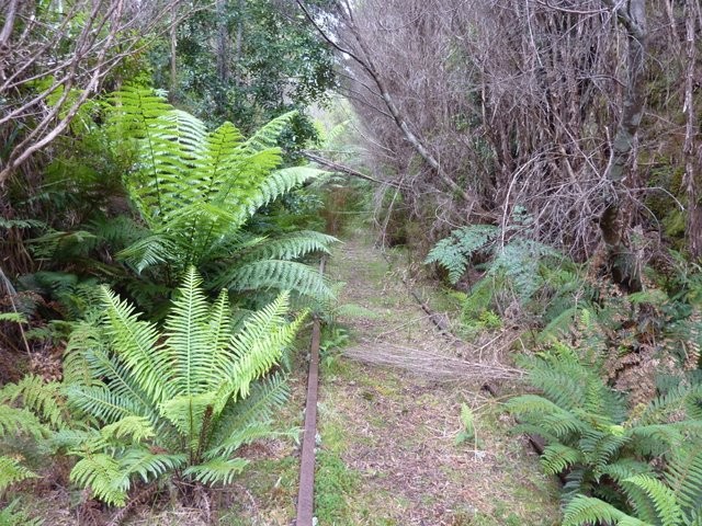
3. Zeehan - Melba Flats: 8km each way. Mediium, but slow. Either follow the old railway line, or overgrown track beside it (or make it a sort of circuit). the railway line is the pure experience, but it's not easy in many places .. but of course it is mainly flat. the track isn't much easier. 45 mins - 2 hrs each way (depending on how lost you get).
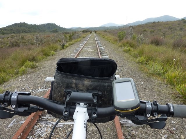
ROUTE MAP
{mosmap kml='https://tassietrails.org/gpsfiles/montezuma.kml|'overview='1'|iconheight='15'|iconanchorx='15'|maptype='terrain'|zoom=7}
ROUTE DESCRIPTION
Zeehan - Melba Flats (8km each way)
Following the railway line across button grass plains, the route is mainly flat, but the ride is bumpy as you decide between riding across railway sleepers or jump from side to side to ride on the clearer gravel outside the railway lines. There's one major creek crossing where you need to get onto the track beside the railway (to the left) and wade across the creek (a great place to clean the bike on the way back). There are also a number of minor washouts which you'll find your way around and a few sections which are pretty wet and overgrown. You won't make quick time along this track, but it is fun, and worth the effort particularly on a sunny day as it contrasts with the rest of the ride.
Eventually you will come to a washed out bridge with a very big drop in front of you. Backtrack a bit and make your way down the left hand side and across the small creek, then follow a track back up to the other side where you'll find yourself on a gravel road. Go right along this gravel road for about a kilometre and you'll come out onto the highway, take a left and 450m along the road you'll find yourself at the Melba Flats car park.
On the return trip, either retrace your route, or for something different instead of going back along the railway track, continue along the gravel track. It swings out to the right a bit as it goes through a eucalypt plantation, but then swings back to the left and parallels the railway all the way back to Zeehan. This trail is a little bit faster riding, but I found myself pushing through very prickly and overgrown scurb and knee deep in water in other sections. This ride is definitely not for arachniphobes as I swear I was covered head to toe in cobwebs by the time I got back to my car.
If the ride out was a bit of a challenge, the other option is to just return along the Murchison Highway, a distance of just over 10kms back to where you left your car.
Melba Flats - Montezuma Falls (14.5km each way)
The first 8kms are a steady climb, gaining about 250metres in height, initially along a quite good gravel surface which slowly deteriorates as the kilometres pass by. The good news is when you reach the Ring River Junction you're pretty much at the top, and from here it's 6kms of downward riding on fun technical tracks as you lose about half the height you've just gained. Be aware that there are several creek crossing where the bridges have collapsed and where the track is very steep and rocky. A more subtle hazard is the logs and rocks that have been hauled into ruts and puddles by bogged 4WD vehicles that can easily catch a tyre.
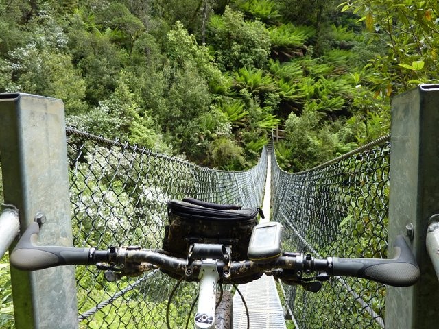
The reward at Montezuma Falls is all worth it though, and it's hard not to set yourself up for a few photos as you carry your bike across the metal suspension bridge. Return via the same route ... though that Ring River road is calling out to me next time I head out that way ...
Montezuma Falls - Williamsford Car Park (5.5km)
The riding on this side of the falls is another world. Restricted to bike and foot traffic (do be careful of walkers) the mud virtually vanishes and you find yourself on a beautiful track where you'll probalby spend more time working your camera than your pedals. The first 500 metres from the falls is a bit rough, and slightly downhill, but then the track surface smoothes out as it heads out to the car park. It is a slight incline the whole way (another reason to ride North to South if riding one way) but you'll hardly notice it.
Just before you emerge out into the car park, the pedestrian trail drops off the railway line to the left. Cyclists need to continue following the vehicle trail down to the right, through a small river, up the steep incline on the other side and then out to the car park. If staring from the car park the cyclist route is signed and easier to follow. To be honest other than ticking off the "complete trail" there's no reason to continue past this last creek.
Photos


Map
Editor review
User reviews
Review

Review
This time I chose to start at the Melba Flats roadside 'carpark' on the Murchison Hwy located not too far outside of Zeehan. Lookout for signage on the right hand side if heading from Zeehan opposite a road leading to a mining co. From here it's 14kms to the falls following a rather wet & muddy 4wd track even in Summer. The final 3.5kms from the Ring Rd junction is pretty much all downhill, a welcome relief after 10.5kms of steady uphill pedalling. This time I chose not to ride the 5.5kms from the falls to the Williamsford car park, instead heading back the way I came up to Melba Flats. No one should get lost on this section.
Next I headed to Zeehan to take in my favourite section of the track. Okay from Melba Flats ride down the hwy for approx. 500m where you'll see a gravel road on your right. Turn down here and around 100m from the hwy you'll be faced with a road block. Go under or around this yellow gate and approx. 1km further on you'll go under an old railway bridge. Now here's the key to staying 'on track'.
Once past the bridge the gravel road you're on veers to the right but go straight on instead following a less defined track. Almost immediately after this the new track you're now on also veers right, this time keep following it to the right ( don't go straight). Now around 2kms later if you want to follow the old railway line you'll come across a gravel road on your left, turn down here and the rail line is basically right there for you to follow. I turned down here so I could experience the rail line on the way to Zeehan and the 'bush' track running parallel to the rail line on the way back to Melba Flats. If not don't turn here, following the track you're already on all the way to the outskirts of Zeehan.
Both the rail line and the adjacent track are heavily overgrown with plenty of standing water to wade through but mainly you're ducking and dodging tee trees that have fallen across your path. The rail line is shorter and therefore quicker but you won't save that much time not taking the track next to the rail line so I really recommend you do both tracks, they're both a great experience.
Hope this proves useful to any future users of this terrific ride.
Steve
The upper section (above the falls) is closed to vehicles and is a beautiful ride under the myrtle forest, across a stream, and past some old mining tunnels. This section is quite flat, and should not challenge most riders (as long as you're happy to get wet!)
The section below the falls, where 4WD access is allowed, is very muddy, especially during the winter season. There are a couple of creek crossing with steep pinches, but for the most part this is also a pretty easy ride, following the old tramway. Watch our for 4WDs (although you'll probably be faster than them in some of the trickier sections).
Overall this is a very beautiful track; the falls are definitely a highlight. Not very difficult, but you'll be riding through lovely rainforest and myrtles for the most part.
Review
Review
We parked at the Melba Flats but instead of returning back the way we came decided to take the highway back to the car. This is around a 20km ride from the Williamsford car park and is a real lung buster with steep inclines a plenty so this route should not be under-estimated especially after slogging it out for 20kms along the muddy tracks. We were very happy to finally catch sight of the car I have to say but what a ride.
Resources
Other Resources
-
{{#owner}}
-
{{#url}}
{{#avatarSrc}}
{{name}} {{/url}} {{^url}} {{#avatar}} {{& avatar}} {{/avatar}} {{name}} {{/url}} - {{/owner}} {{#created}}
- {{created}} {{/created}}