- MTB
- Snug Tiers (Grey Mountain and Pelverata Falls)
Snug Tiers (Grey Mountain and Pelverata Falls)
Hot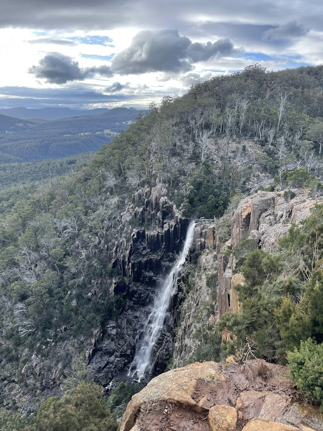
Key Statistics
- Nature Recreation Area
Location
This ride ties together a couple of out and back rides to Grey Mountain and Pelverata Falls into a loop of sorts. It will onlyappeal to more adventurous local riders who don't mind some really rough tracks and who are looking for a short bit of technical riding with some nice views at the end.
However it can also make a great day out for less experienced riders just so long as you are willing to walk your bike a bit. There are plenty of options to extend or shorten this ride for those looking for more or less hours in the saddle.
GETTING THERE
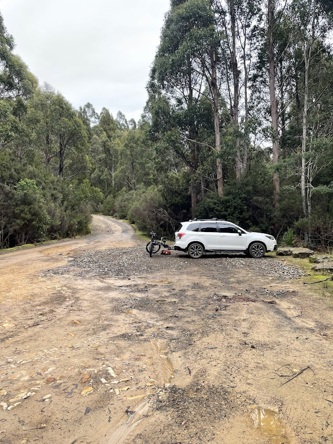
Head to Margate, 20kms south of Hobart. Once in Margate travel 250m past the BP Service Station / Banjos Bakery and look out for Van Morey's Road heading off to the right.
Those looking for a longer ride can park in the carpark here (there is a public toilet behind the big red building).
Otherwise, turn up this road and drive about 10kms to the top car park. The last 2.5kms of the road are very rough, and the last 1.2kms in particular is only for high clearance vehicles with 4WD, however with careful driving most cars should be able to drive to a small flat area on the right hand side of the road about 9kms from the start of the road. Ultimately it's up to you how far up you go.
The top car park is a small open quarry area 10.2kms from the start just where the road flattens out. If you see a white gate you've gone too far.
ROUTE OPTIONS
Other than extending your trip by starting at one of the lower car parks, there are also some other cycling and walking options you can consider up on Snug Tiers.
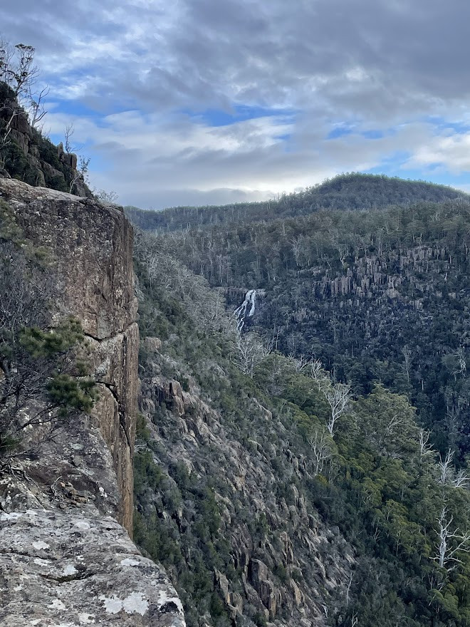
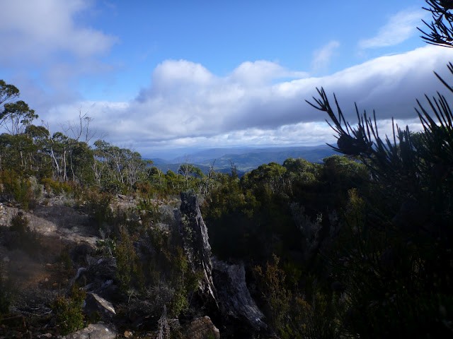
Firstly you can of course just do either the Grey Mountain or Pelverata Falls routes as out and back rides. Pelverata Falls is shorter and has a more scenic end point, but the track is tougher and more technical than the Grey Mountain track. The Grey Mountain track is definitely easier and faster riding (except the last pitch to the top) but to be honest the views from the top are at best 'OK' - you're heading there for the solitude and trails, not for the view.
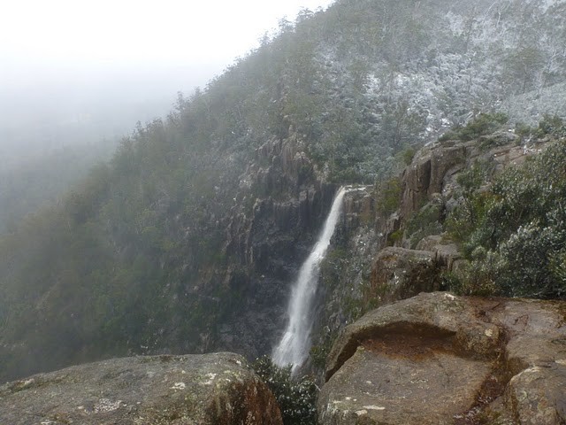
Those who are out here for the scenery may enjoy the walk down to the bottom of Pelverata Falls (the MTB route comes out at the top). You have to walk down to the top of the falls and cross the creek and head up the slippery flow stone on the other side from where you can pick up a cairned foot pad that will lead you steeply down to the base of the falls (joining the walking track that comes in from Pelverata). This track is hard to follow, and extremely dangerous as it descends a rock scree. It should only be contemplated by very experienced walkers who bring some decent walking shoes in with them. Don't even think of carrying your bike down here. Allow at least an hour to do this return walk.
There is also an exit down to Kaoota from the top of Snug Tiers, but like the exit out to Cygnet, the section at the bottom goes across private property and is closed to mountain bikers.
WARNINGS
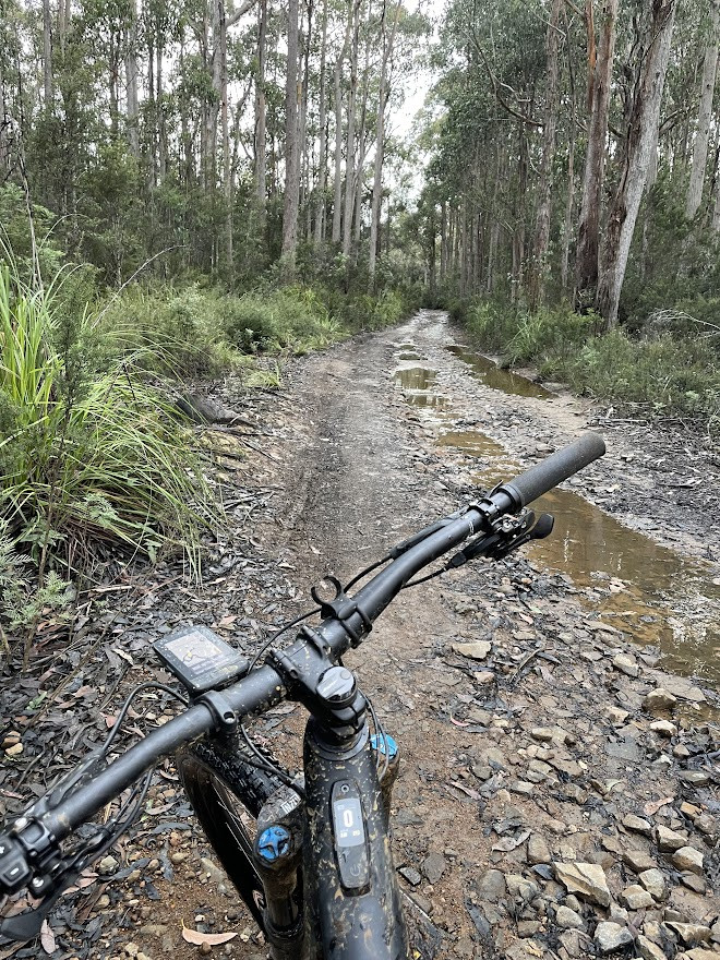
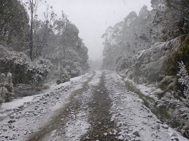
This ride is at altitude (above 600m) and the winds can get biting up here, so have some good warm clothes and wet weather gear. You will get wet feet on this ride even in Summer - accept this early and you'll have more fun.
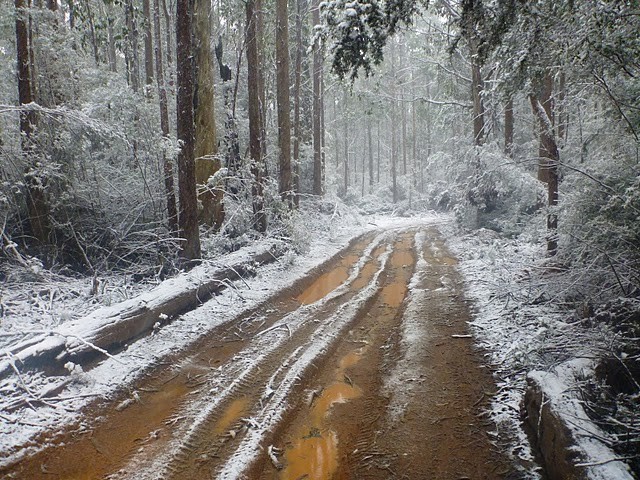
This can be a great place for winter snow riding near Hobart, but only for those who have the right winter gear.
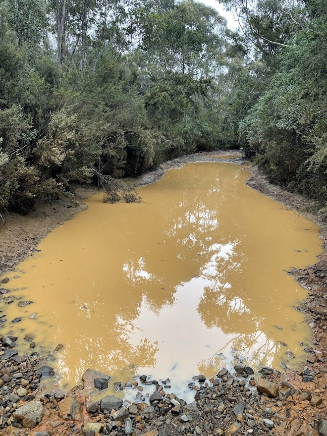
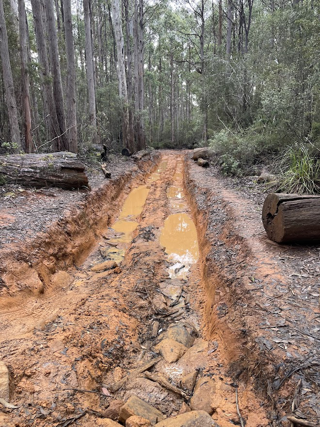
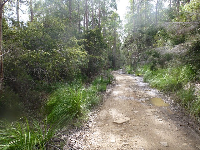
Lots of opportunities up here for accidents as the trail is very rocky and slippery in places, with some very deep puddles, and you might not always have phone reception. Despite it's proximity to Hobart treat this as a remote area ride, carry a first aid kit and let someone know where you've gone.
ROUTE DETAILS
Assuming you start at the top car park (otherwise from wherever you start just ride uphill until you get to the top car park, and yes the last 2kms is very steep) continue down the 4WD track.
It's slightly uphill for the first half a kilometre, and you'll get your first taste of the puddles to come. 0.5km from the start you'll come out into an open area with tracks leading off to the right and left. Continue straight ahead. The track starts heading downhill from here. The track to the right is the alternate route exit to Kaoota which is for experienced riders only (see route options).
There are a couple of small tracks that head off to the left and right, but if in doubt stick to what looks like the most used track and 2.2kms from the start keep your eyes out for the turn off to your left which takes you out to Grey Mountain. Unless you're just heading straight out to Pelverata Falls, turn left here. When I was last here there was a pole, but no signage indicating the turn.
If heading straight to Pelverata Falls continue straight ahead for another 800 metres and you will come out at an old sawmill site on your left. Continue straight ahead through a messy section of track divergences. Just past the sawmill site (3.2kms) you'll come to a Y junction. The left fork is where the main route comes in from (skip to this below). You'll go right.
For those doing the larger circuit after turning left follow the track down across a fairly new bridge and then up into some bushland, at 2.9km from the start keep your eyes out for a rutted 4WD track heading off to your right - this is where you head down on your way back to get across to Pelverate Falls.
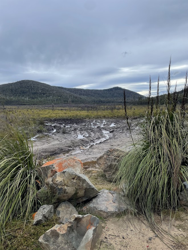
For now though continue straight ahead, ignoring turn offs on your left at 4.9kms and 6.3kms from the start. (July 2002 update: These used to be nice little out and back explorations out to some water catchment dams, but both dams have now been emptied so are not really worth the detour).
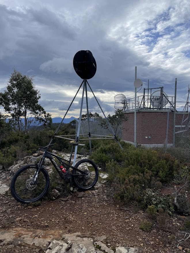
7.8kms from the start you will come to a very obvious four way junction where you need to turn right and start climbing the last section to the top of Grey Mountain (following the power lines). The track straight ahead used to drop you out behind Cygnet but the private land owner at the other end no longer lets people through.
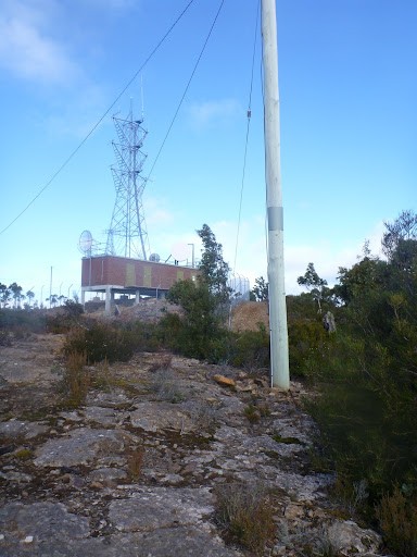
The last 1.2kms to the top is very steep with an average grade of 12%, and the reward isn't that great with quite limited views and an ugly communicatons building. But you do get to take a photo next to the trig point and it is a very fun downhill run back down if you make the effort to push/ride up. I took my eMTB on my last ride up here and it was a lot of fun.
Once you've had your fill of the views, turn you wheels around and head back the way you've come. At about 15.2kms from the start you should get back to that 4WD track you passed on the way in at 2.9kms. Turn down this and make your way through this fun, muddy and rocky track as it heads down behind the sawmill site and around to a Y junction at 16.5kms from the start. There are some very deep puddles on this section as it is little used, so if that's not your cup of tea, you could just retrace your steps to the junction and head in that way. This is where the track rejoins for those who didn't go out to Grey Mountain.
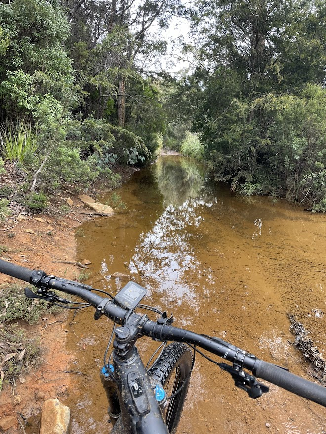
Turn left here. And cross the creek and start heading up the hill on the other side.
This short, but steep, climb (16.9kms) gives you a taste of the technical (muddy and rocky) riding you'll be doing out to the falls and don't be surprised to find yourself pushing for sections. It is however all downhill until you come to an obvious junction on your right (17.7kms).
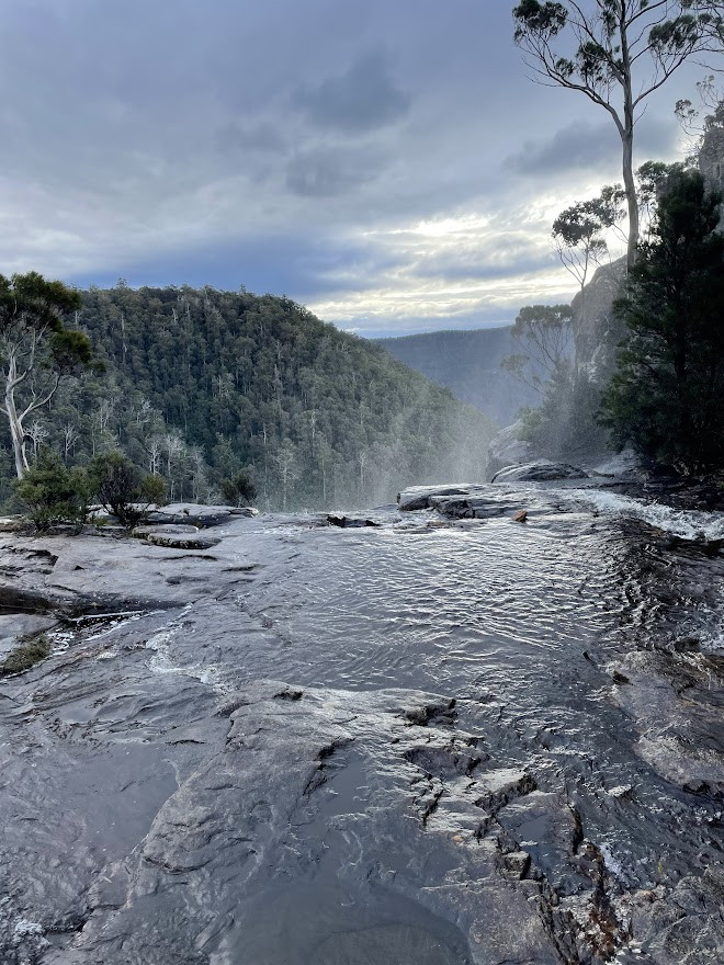
Turn right at this junction and follow the track (ignoring the turn off to the left 100 metres further along) all the way to Pelverata Falls (19.1kms) noting that this is the muddiest section with the deepest puddles. Don't be worried by what seem like multiple tracks heading off in different directions as you get towards the end. They are all just diversions where vehicles have tried to find new ways around puddles and they will all lead to the same car park in the end. You can get good views out over the falls from the end of the car park, and it is definitely worth following the foot pad down to the top of the falls (it's only about 200 meres).
From the falls retrace your route to the old sawmill site and continue straight out along the track to your car. It's about 6kms back to your car from the top of the falls, making a total distance of 25 kms.
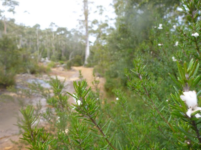
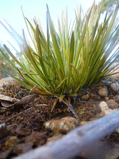
Photos


Map
Editor review
Review

User reviews
Resources
Blogs, Articles etc.
-
{{#owner}}
-
{{#url}}
{{#avatarSrc}}
{{name}} {{/url}} {{^url}} {{#avatar}} {{& avatar}} {{/avatar}} {{name}} {{/url}} - {{/owner}} {{#created}}
- {{created}} {{/created}}